Climbing Coropuna
Also known as: Qhuru Puna / Golden mountain

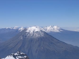
Coropuna, nestled in the Andes of southern Peru, is an imposing volcanic massif that demands respect from those who seek to conquer its heights. Standing at an impressive 6,425 meters (21,079 feet), it is the highest volcano in Peru and the third highest peak in the country. The mountain offers a variety of routes, each presenting its own challenges, with the standard route typically being approached from the north via the small town of Chuquibamba. This route is favored for its relative accessibility and the chance to acclimatize gradually while taking in the stark beauty of the Andean landscape.
The climb itself is not overly technical, but its altitude and glaciated terrain require sound mountaineering skills and proper acclimatization. The route is characterized by long stretches over snow and ice, with crevasse navigation being a critical component. Weather conditions can be unpredictable, with strong winds and sudden snowstorms posing potential hazards. While the ascent is considered moderate in difficulty, the altitude is the real test, often necessitating a slow and steady pace with strategic camp placements to ensure climbers are well-acclimatized before the summit push.
Coropuna is less frequented than other peaks in Peru, offering a more solitary experience that many mountaineers find appealing. The summit itself presents breathtaking views, with the vastness of the Andes sprawling out in every direction. For those interested in making the ascent, there are 5 guides that offer expeditions up this majestic mountain. These guides can be a valuable resource, providing logistical support and local knowledge to enhance the climbing experience.
Difficulty
- F: Easy (alpine grade 1)
When to go
- June to August
Guide links
View 5 Guides for Coropuna
Coropuna History
Climbing history of Coropuna
The history of Coropuna is steeped in the rich cultural tapestry of the Andean civilizations. The mountain, revered by the indigenous people, is believed to have been an important ceremonial site. The Inca, in particular, held Coropuna in high esteem, considering it a sacred mountain or "apu." Evidence of ancient rituals has been uncovered on its slopes, including offerings and ceremonial platforms, indicating its spiritual significance.
Early summit attempts on Coropuna are shrouded in mystery, with local legends and tales hinting at possible ascents by ancient peoples. The first documented ascent, however, is credited to the American explorer Hiram Bingham in 1911, better known for his discovery of Machu Picchu. Bingham's expedition brought attention to Coropuna, sparking interest in further exploration and study.
The surrounding region is home to communities that have lived in harmony with the challenging environment for centuries. The people of this area have developed a unique cultural identity, deeply intertwined with the majestic landscapes that surround them. The traditions and way of life in the shadow of Coropuna continue to be influenced by their rich historical heritage.
Base Camp
High Camp
Summit
Coropuna access - getting there
How to get to Coropuna
Coropuna Links
useful websites, Groups and communities
Groups / links with more info on the Coropuna route.
These climbs are similar in length, difficulty, and elevation. Offering a similar level of challenge as the Coropuna climb.


