Climbing Parinacota


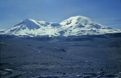
Parinacota, a majestic volcanic mountain straddling the border between Chile and Bolivia, stands at an imposing 6,348 meters above sea level. This stratovolcano is part of the Andes' Cordillera Occidental and offers a challenging yet rewarding climb for seasoned mountaineers. The ascent is characterized by its high altitude, requiring climbers to be well-acclimatized. The standard route is via the southwest approach, which is often attempted in a two-day expedition. The climb itself is not technically demanding, but the conditions can be harsh, with strong winds and cold temperatures being common. Therefore, it's crucial to be prepared for the elements and to have the necessary experience in high-altitude climbing.
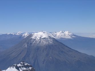
The climb up Parinacota is a true test of endurance and determination. While the route is largely non-technical, the altitude poses the greatest challenge, demanding a slow and steady pace. The ascent typically begins from the base camp at around 5,200 meters, where climbers spend a night to acclimate before pushing for the summit. The terrain consists of scree, snow, and occasionally ice, making sturdy boots and crampons essential. Weather conditions can change rapidly, so monitoring forecasts and being ready for sudden shifts is vital. The panoramic views from the summit encompass the expansive Altiplano and the neighboring Sajama National Park, rewarding climbers with breathtaking vistas.
For those planning to tackle Parinacota, it's advisable to consider the logistics involved in reaching the remote location, as well as the need for appropriate permits to climb. While the mountain is relatively accessible, the journey to the base often requires a rugged drive through challenging terrain. When it comes to organized climbs, there are 6 guides who offer expeditions to Parinacota. While experienced mountaineers can certainly undertake the climb independently, utilizing the expertise of local guides can enhance safety and ensure a more culturally immersive experience.
Difficulty
- F: Easy (alpine grade 1)
When to go
- December to February
- May to October
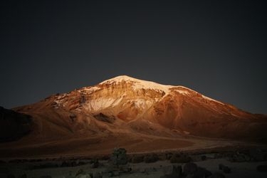
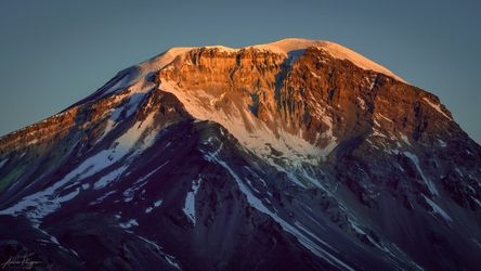
These are pictures taken while climbing Parinacota. They're shown here to give you an idea of what the route is like. You're welcome to share your own pictures of climbing Parinacota, to help the community of climbers. Picture here are either uploaded by members (their own, or creative commons pictures), or guides.
Guide links
Parinacota History
Climbing history of Parinacota
The history of Parinacota is rich with cultural significance and early exploration attempts that have contributed to its allure among mountaineers. The Aymara people, indigenous to the region surrounding Parinacota, have a deep connection to the landscape, viewing the mountain as a sacred entity within their spiritual beliefs.
Though specific early summit attempts are not well-documented, the mountain's challenging terrain and high altitude would have posed significant obstacles to early explorers and climbers. In more recent history, Parinacota gained attention from mountaineering enthusiasts attracted by the opportunity to conquer its impressive heights and experience the breathtaking views from the summit.
If climbing from Bolivia, most will take a ride straight from Sajama village to the trail head / refuge and start their ascent. Alternatively walk (or drive) in and stay the night there first for more acclimatisation. There is also a space to camp at ~4850m (but ultimately you can camp anywhere - this spot is just used as it's about as far as some vehicles want to go).
Parinacota Links
useful websites, Groups and communities
Groups / links with more info on the Parinacota route.
These climbs are similar in length, difficulty, and elevation. Offering a similar level of challenge as the Parinacota climb.