Climbing Dorje Lakpa

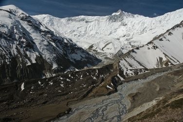
Dorje Lakpa is a remarkable peak in the Langtang Himal range of Nepal, standing at an impressive height of 6,966 meters. Its elegant pyramid shape is striking against the skyline, offering both aesthetic appeal and a technical challenge. The difficulty of Dorje Lakpa should not be underestimated; it's a serious undertaking requiring technical skills and experience with high-altitude climbing. The mountain is known for its mixed climbing conditions, with ice, snow, and rock sections demanding proficiency in all these terrains. Avalanches and unpredictable weather can quickly turn the climb into a daunting test of skill and endurance.
The ascent typically begins from the village of Syabrubesi, following the Langtang Valley trail, which offers a window to acclimatize before reaching the snowy heights of Dorje Lakpa. The approach is scenic yet rugged, taking you through lush forests and traditional villages, setting the stage for the challenges ahead. Once at the mountain’s base, the climb involves navigating steep ice faces and crevassed glaciers. The standard route on the north face requires careful navigation through seracs and cornices, making route-finding skills essential. Camp placements are crucial, with strategic sites offering relative safety from the mountain's inherent hazards.
Reaching the summit provides a rewarding panorama of the surrounding peaks, a testament to the climber's perseverance and skill. It's a climb that demands respect and thorough preparation. With the right conditions and timing, Dorje Lakpa can be a fulfilling endeavor. Five guides offer expeditions for those seeking to tackle this formidable peak, catering to those who are ready for its challenges. This is a mountain that will test your skills and spirit, leaving you with an unforgettable experience of high-altitude climbing in Nepal.
Difficulty
- D: Hard (alpine grade 4)
When to go
- April and May
- October
Guide links
Dorje Lakpa History
Climbing history of Dorje Lakpa
In the history of Dorje Lakpa, early summit attempts were marked by the challenges posed by its steep and technical routes. The first successful ascent of Dorje Lakpa was made in 1981 by a Japanese expedition team led by T. Inoue. They approached the mountain via the northeast ridge, which remains the standard route for climbers today.
The region surrounding Dorje Lakpa is inhabited by the Tamang and Sherpa people, known for their rich cultural heritage and traditional lifestyle. Their knowledge of the terrain and expertise in high-altitude environments have been invaluable to climbers and explorers venturing into the Himalayas.
These climbs are similar in length, difficulty, and elevation. Offering a similar level of challenge as the Dorje Lakpa climb.


